
The ocean is a dynamic and powerful environment. Sometimes, particularly after a major storm, acoustic moorings can break, and receivers wash up on nearby shores. Other times, those receivers embark on multi-year journeys across the ocean, drifting far beyond where we expected them to go.
Situated about 175km southeast of mainland Nova Scotia, Sable Island lies at the western edge of the Gulf Stream on the continental shelf, near the beginning of the continental slope. The constantly shifting sandy shoreline and ocean bottom create a challenging environment for scientific study. But study we must! This location is important for a large population of grey seals, who use the island’s beaches and surrounding waters for pupping and overwintering. These seals are the subject of several projects, including a long-term monitoring program being carried out by Fisheries and Oceans Canada (DFO) and Dalhousie University, as well as telemetry investigations by OTN-supported researchers.
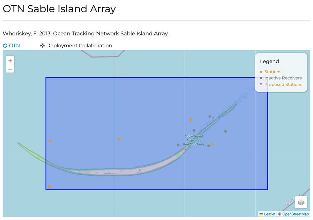
In 2013, a moored array of acoustic receivers was deployed around the island to determine whether acoustically tagged predators, such as white sharks, come to Sable Island to hunt grey seals. This array also serves to log other acoustically tagged animals who might be attracted to the island, including top-level predators, like blue sharks and Atlantic bluefin tuna, that have been detected in the surrounding waters. OTN continues to maintain this array to keep this important data flowing.
Data from the Sable Island Array is typically collected by OTN’s Wave Glider—a surfboard-shaped autonomous vehicle. However, sometimes things don’t go as planned. One VR4 receiver from the array, originally deployed in 2018, stopped communicating with the Wave Glider in 2021, and after unsuccessful recovery attempts, was declared lost in 2022.
All hope of finding the lost receiver was gone until 3 years later. In July 2025, Rolf Pettersen contacted OTN saying that the VR4 washed up in Kjøllefjord, Norway. The village, located on the northwestern part of the Nordkinn Peninsula, at the very northern tip of Norway, is roughly 5000 km from Sable Island if measured in a straight line. We needed to work on getting the VR4 back to OTN headquarters at Dalhousie University! Not only could we then redeploy the receiver, saving us from purchasing another, but we could offload the invaluable data collected. These units are heavy and not easily transported, but thankfully, we’re a global network!
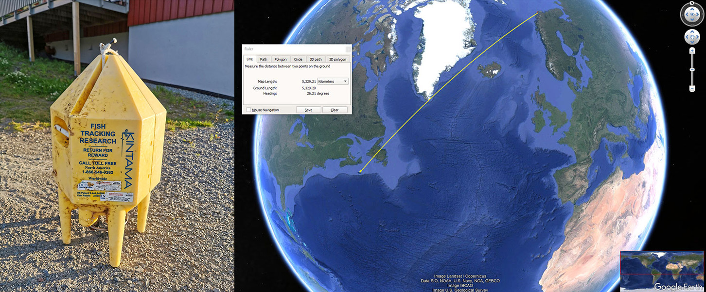
One of OTN’s senior field technicians, Iago Gradin, started the process to get the equipment back, with the key step of ensuring the finder removes the lithium battery prior to shipping.
In September 2025, Iago asked former executive director, Fred Whoriskey, if he knew anyone in Norway who could help, and Fred suggested OTN collaborator Jan Davidsen. Jan contacted Rolf, who agreed to drive 500 km to drop off the equipment at a police station in Vadsø, where it was collected by Jan’s colleague, Eirik Frøiland. Eirik held the unit for about a month, and on October 20, he drove over 400km to meet Jan, who was attending a conference in Svanhovd, to pass the VR4 along. Jan removed the battery from the receiver, packed the unit for shipment and left it at Norwegian Institute of Bioeconomy Research, NIBIO Svanhovd with his colleague Anne Wikan. Iago finished coordinating the shipment back to Halifax, and it finally arrived safely at headquarters on November 12, 2025!
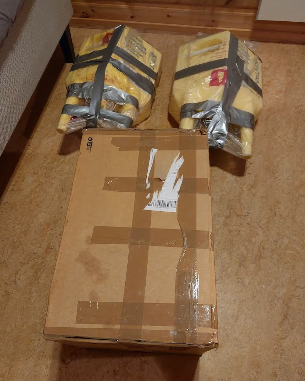
Lost VR4 packed up and ready to be shipped.
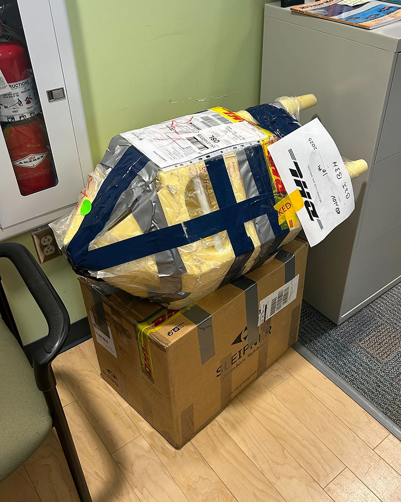
Lost VR4 arriving at OTN headquarters.
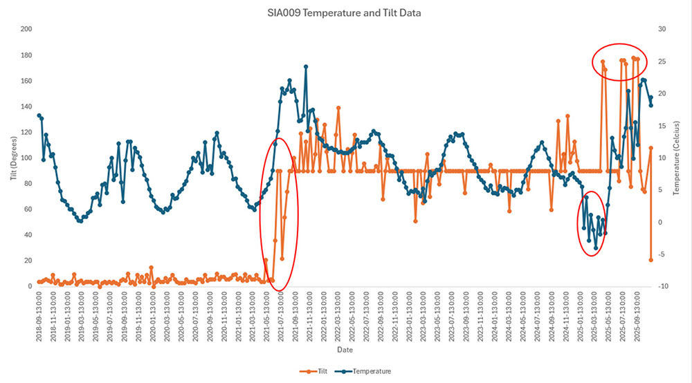
While the exact journey this VR4 went on can’t be 100% mapped, Iago analyzed the data to try and piece together the likely path. Based on the receiver’s tilt data, the unit appears to have broken free in June 2021, briefly beaching itself in July (most likely at Sable Island) before drifting off to the other side of the Atlantic. It’s estimated to have arrived in Norway in January or February of 2025, based on temperature readings as low as –2ºC—meaning it was drifting around the Atlantic for over 3.5 years! Tilt data from April 2025 suggests that this is when it landed and was recovered by someone, as the sensor recorded a 180º orientation. A 180º tilt happens when the Kintama float collar—which houses the receiver—is standing upright, a position that is highly unlikely to occur naturally on land or while drifting.
It was quite an adventure for a little VR4 to go on! We’re glad to have it back, with valuable data recovered for multiple projects, but next time, please stay closer to home!